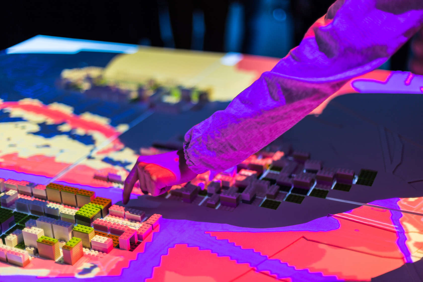

There’s a wide range of tools used by architects and planners to communicate the potential impact of major projects. Drawings, for example, are one of the most basic, as are masterplans, market studies and environmental surveys. None of these, however, are quite as accessible and powerful as a series of interventions being developed for the CityScope Project at MIT’s Media Lab. CityScope uses augmented reality to quickly and simply model the effects of large-scale urban-planning decisions. The technology employs special LEGO bricks on a tabletop with overhead projectors that beam color-coded metrics onto each brick. Every LEGO piece is assigned a user-determined variable such as “200-unit residential building,” “10-acre park” or “4-lane road.” The bricks are then assembled on the tabletop to represent an existing neighborhood, city or region, and users are able to pick up and move, remove or insert individual components at will. MIT’s CityScope demonstration. Viewing on mobile? Click here. As the components are modified, a special chip in each LEGO piece communicates with the overhead projectors, which beams metrics affected by each decision onto the new configuration. For example, if you placed a “200-unit residential building” piece onto a previously empty plot of land, the color ... , Ross Brady, read more Architizer http://ift.tt/2cWhVpZ


Yorumlar
Yorum Gönder